Feel free to hum along with me. The Willy Nelson version or the Canned Heat version. You choose. Let me know.
Day 1
I left just before lunchtime on Monday 15th and headed west, where Mae West told Randolph Scott to go in 1936, covering old ground as far as Daylesford but instead of turning right towards Mount Franklin and its mineral water and its weekend noise I veered left towards Ballarat.
Through Ballarat, a couple of well sign-posted (ha!) exits and an hour or two later I found myself in downtown Derrinalum, gateway to Lake Deep, or “Deep Lake” as the locals call it. At Deep Lake there is a camping ground that’s maintained by the local fishing, yachting and power-boating clubs, and they charge $10 pppn plus $2 for a shower token. I paid for two nights and two tokens, purchased a p-p-p-perking monster flat white and moseyed out to the Deep Lake.
It was raining when I arrived. (Don't forget to click on a photo if you want to see a larger version)


So I parked, away from branches that might go thump in the night …

… and took my coffee down to the covered barbecue area to see what the clouds would do.

After a while the clouds did part …

So I was able to capture some nice pastel colours in the sky

Some great cloud formations reflected as the wind dropped away
And some nice texture on the lake. I didn’t want to wake that duck.

The setting sun lit up the clouds with a ray going from one side of the sky to the other

And finally I waited for a deep voiced announcement, but it didn’t come

Day 2
It rained overnight, and the next day it rained most of the day until about 4pm, so I watched a few TV shows and caught myself napping. Later the clouds did their parting thing again …


And watched as various birds flew home across the lake.


The sky got darker

And the moon showed through the clouds overhead

Finally the sun started to go down …

… creating a spectacular orange backdrop for the pelicans to glide home …

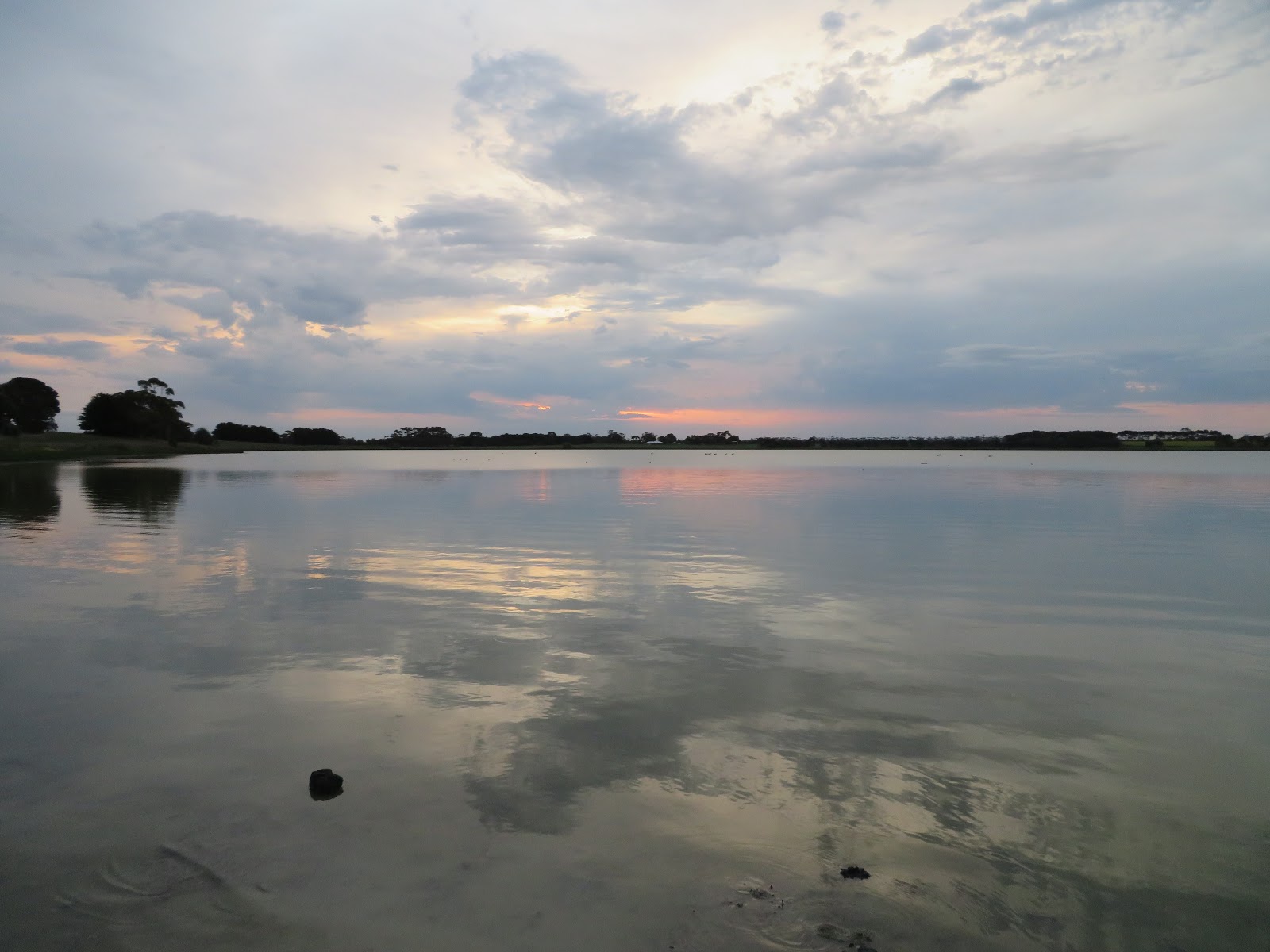
Then the whole sky flooded with orange, and reflected across the entire grey-blue lake.

Breathtaking. Worth the inactive rain-constrained day.
Day 3
I collected another coffee from the nice lady at the Derrinalum take away shop cunningly called Take Aways, and headed west again. Stopped in Hamilton to purge the coffee, continued northwest, and a little while later turned off the highway to look at Nigretta Falls.
A quick wide-angle from the car park

And I set off down a path to the bottom of the falls. Down 799 steps, or thereabouts (perhaps I exaggerate by 700 or so, but my unfit legs and lungs told me otherwise!) . Magnificent view at the bottom of the falls. A most spectacular sight! Absolutely impressive. So I whipped out the pocket camera ready to take this wonder to the world, turned it on, then watched, stunned, as it scolded me to pay better attention to battery levels in future, before it shut itself down.
Aaargh! I thought.
I was not going to climb up 799 steps (or thereabouts), get a battery, then down 799 steps, take a couple of snaps then climb 799 steps (or thereabouts). Nup.
So I climbed, went back to the car, changed the battery, and headed off. I had only gone a few metres before I realised that while I had been watching in shock as the camera fell asleep, my phone had been in my pocket. Ah well, you’ll have to go there yourself, or look here www.world-of-waterfalls.com/australia-nigretta-falls.html
It was only a five minute drive back to the highway, and across the highway to the camping ground near the Wannon Falls. Again it was raining quite steadily so once again I stayed in the van and twiddled my internet and watched some TV and did the NZH puzzles.
Day 4
Next morning it was still a bit overcast but I set off towards the falls, just under a kilometre away.
Down the track (I found out later that I could simply have walked around the loop road, but this was more fun). The track was dug up by magpies.

For some reason this made me think of a bad hair day.

And there was Wannon Falls, undercut by turbulence when in flood.
But it wasn’t in flood. Hardly even trickling.

So I headed back up the alternate route, and found the tree bark more interesting than the trickle.


And the woodland colours saturated after the rain.


Then it was time to head off to Nelson on the coast, just a few km inside Victoria, near the border with South Australia.
You know the one about making sure to check camera battery levels before descending 799 (or thereabouts) steps? Well it seems that principle also applies to diesel. I was happily travelling along the C and D roads (sealed but narrow and uneven) through vibrant green countryside, admiring the beef cattle (I could tell by the straight backs and square rumps, as learned in Chinchilla!) and the white (!) sheep, when I glanced at the dashboard, as one does, and noticed the fuel gauge below 1/4. I checked the map and when I reached the highway near Dartmoor I turned right, towards Mount Gambier. I knew there would be diesel there, whereas I didn’t know whether any of the smaller towns in Victoria would (Dartmoor had one diesel pump used by truckies).
So off I went, foot light on the go pedal. Reached the border and just after crossing into SA the fuel gauge started flashing and I got a very annoyed beep from the dash. Hmm! Even lighter on the fast button, taking it easy up the undulations and coasting down the other sides (I made plenty of room for following traffic, and fortunately there weren’t many trucks.)
Limped into Mount Gambier and stopped at the first service station. I was down to the last 5-ish litres (enough for 30-40 km when towing). Ooops. Made a note of that one!
Anyway I filled up the ute, and filled up myself on some terribly naughty chips and dim sims. Comfort food to assuage the fuel induced stress.


Then down a very easy road, across the border again, to Nelson at the mouth of the Glenelg River.
It was still very overcast and windy.

These two were perched on a rock in the estuary. I had fun with my new pocket zoom.

These were bobbing around like rubber duckies, in the middle of the lagoon.

And this one seemed to be just angry at everyone and everything.

Then it started raining again so I took the cameras inside.
The next morning was a bit changeable, but cleared enough in the afternoon for me to wander down to the estuary. Along the shoreline was a row of rocks; the two birds from yesterday had been sitting on the large rock in the background.

The estuary reeds are quite attractive. The river mouth is around to the right.

It is home to well behaved flocks of birds such as these black swans.

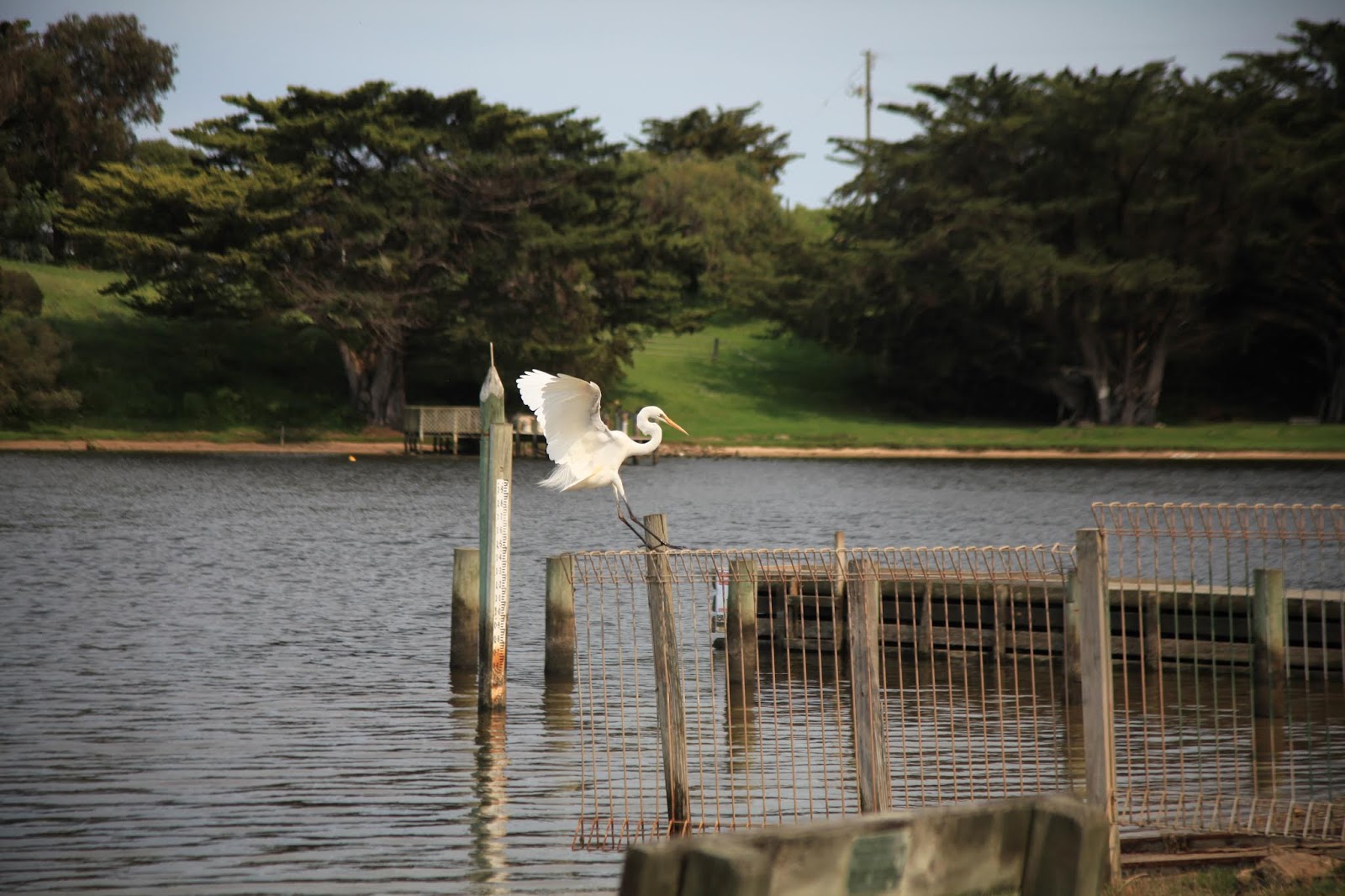
I turned around and a heron landed on a fence just a few metres away.

Then a pelican paddled past

Doing a circuit of the estuary shallows; here preparing brunch near the estuary reeds shown above.

Day 6
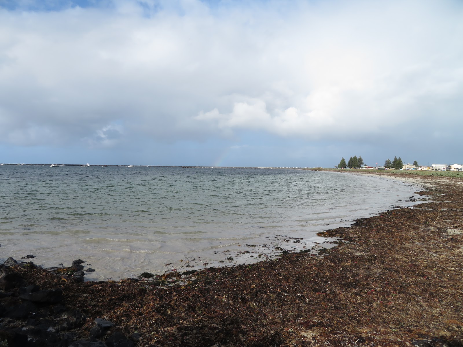
I set off early, across the border yet again into South Australia, and turned left along the narrow coast road towards Port Macdonnell. I stopped at a beach access point. It was still quite windy and overcast.

So I drove on to Port Macdonnell, one of several Southern Rock Lobster Capitals of the World. A small town like so many others, but with a great front yard.
So I grabbed a large cuppa and headed back towards Mount Gambier, where I had just enough time to admire the vivid Vansittart Park and its 1917 Krupp field gun (with its little companion) then get back in the ute …


… when the clouds started crying again.

I turned off the highway towards Lake Frome Conservation Park (not THAT Lake Frome, another one), just west of Millicent on the Southern Ports Highway.
The information boards were very welcoming…

… but when I headed towards the walking track the only sign was not so inviting. You will need to click on this one and zoom to the sign. I wanted to show the sign in situ.

I had already dodged one snake that morning - sunning itself on the road to Port Macdonnell - and I wasn’t knowledgeable or prepared for whatever dangers lurked in the swamp.
So I backtracked a couple of hundred metres and came across a wetland area.
Black swans again.

Ibis (plural: Ibii?)

Dinky little waders

I headed off again to Southend. A couple of caravan parks and a general store and some boarded up shops. A bit bleak and run down on the surface, and some severe erosion of the dunes upon which everything is built, but magnificent beaches and a whole fleet of cray (lobster) boats, so no doubt some wealth lurking out of sight.
I continued up the coast to Beachport. Quite different, with a historical flavour

A big long jetty (pier)

And no access to quite a fine little breakwater

In fact there were quite a few other restrictions

Fortunately I was allowed to breathe behind closed doors, and lived to tell this tale.
I continued up the coast to Robe, which was very polished and developed, but not really my style (I was not even inspired to take a photo), so I pushed on. More information about Robe (with photos) at www.robe.com.au
Stopped once at a rest area to stretch legs and look at the clouds.

And so I arrived at Kingston SE (that’s the name of the place, and don’t forget the SE!). Parked in the caravan park …

… and admired the lighthouse …

… before wandering over to the beach, just across the road from the van.

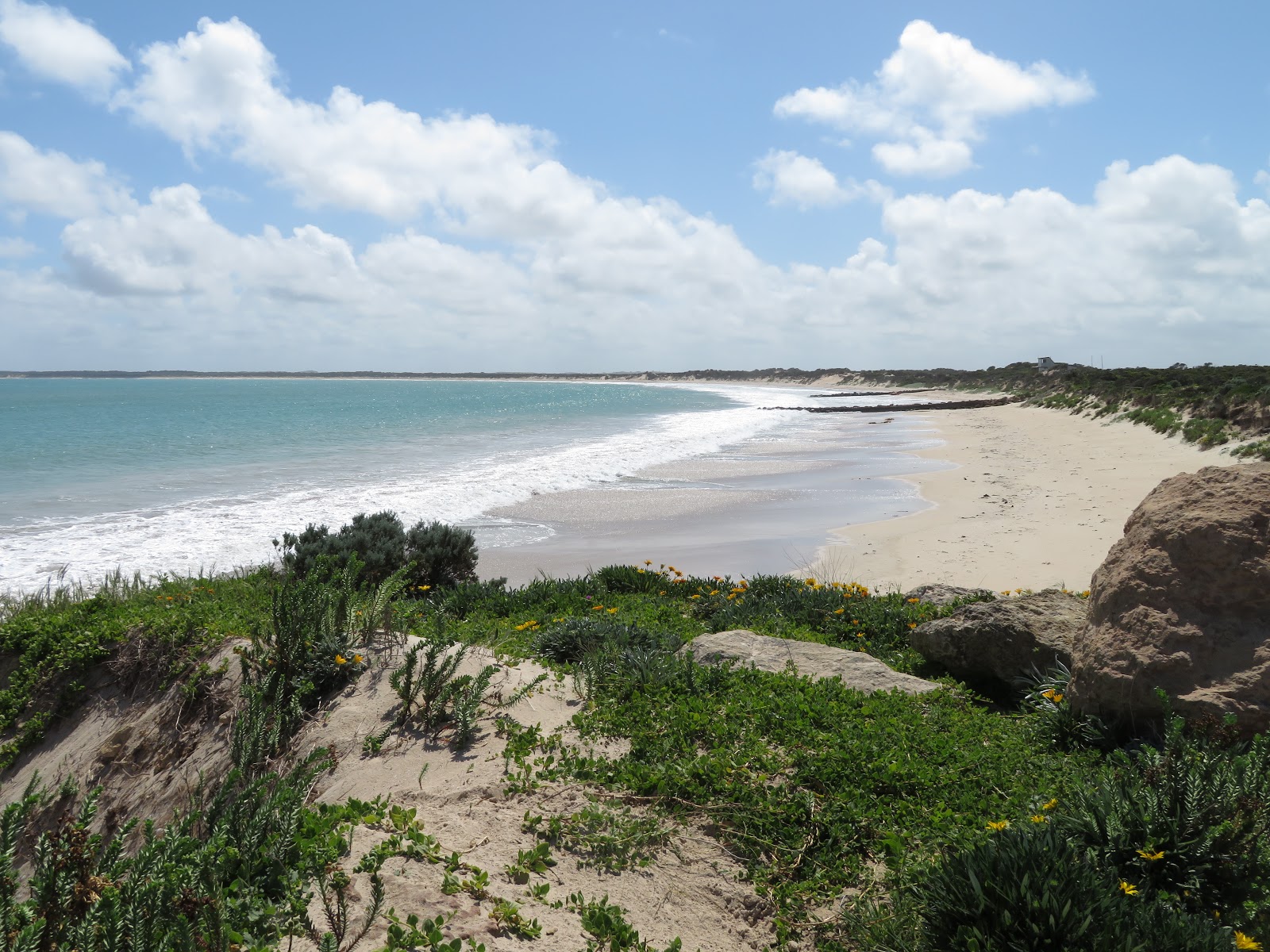
There was a lot of beach to the south …

There was a lot of beach to the north ...

And there was evidence that this was an ocean beach.
 |
| A scallop walks into a bar and asks for a beer. "By the way. Do you serve shellfish?" "Yeah. Grilled or fried. That'll be two clams." |
It was overcast and the evening wasn’t spectacular so I retired and started sorting through my photos which by now had multiplied to over 700. Moral: more doesn’t mean better. So true in so many things.
Day 7
I wandered down to the beach on Sunday morning, as one does, to have a look before sunrise.
It looked a bit bleak to the north, towards Adelaide …

… and to the south where I had come from …

… and to the west where I wasn’t going any time soon.

But there was a spark of hope from the east ...

... which shed some light on the shifting sands.

On the way back to the van I couldn’t help noticing all these worms on the ground. Were they stranded? Would they be safe? What's it all about?

I spent another day sorting through the photos and started the blog, in between wandering over to the beach to check that it was still there (it was) and making sure it was sunny (it was).
Once again the sunset was spectacular.
I went back to the beach and once again the sand caught my attention

But the sunset was the main game

Over a dead calm ocean


Day 8
Up with the dinosaurs and showered by 6 (local time, 6:30 when living in a more advanced state). Packed and lowered the roof, gas off, checked everything, and off I went.
I didn’t get far. I looked at the fuel gauge, which didn’t say much - it seldom does, and it was down to 1/2 so I stopped to fill it (lesson learned, for now), grabbed an extra large flat white at an outpost of the Robe Bakery, and took a photo of the poor unwanted Big Crayfish/Lobster (probably feels a bit dejected with the For Sale sign in front. It’s been there a while, too, although I see that someone has put a SOLD poster over the sign - whether that is for the restaurant or the Big Crustacean I don’t know.

So I moseyed right along, singing the Kentucky Fried Song (from the 70s, here … youtube.com/watch?v=0YtAVIGq1ko … watch it! It is part of my persona, just like all the other 60-ish years' worth of unforgettable jingles and ads and accumulated dross that I can’t get rid of and that rattle endlessly to front-of-mind when I least expect or want) and anyway I was feeling a bit relaxed and cruisey early in the morning. Not much traffic around. No Willie Nelson this morning, more like a Beatles ballad and Eagles sort of day.
Suddenly there was a sign (on a post, not emanating from a cloud - just thought I’d clear that up) pointing to The Granites. Piqued with interest, since I’ve always been interested in Granites, from time to time. Occasionally. Ever since Gillian took me to see the Moeraki Boulders when I was 14. Nearly 50 years ago. In her buzzy little Mini.
Anyway the sealed road led to a parking area and a sand track leading down to the beach.

There was clear evidence that 4WDs were getting bogged up to the axles just around that lower corner, as they tried to come back up, off the beach, with big piles of loose dry sand where they had been dug out. Ah the schadenfreude. Should touch some wood, better yet, touch some logs. Spit Spit. Sign of horns. Salt over the shoulder.
Just along from the sand track on to the beach were The Granites.

At first glance they looked somewhat similar to the spherical Moeraki Boulders, but a side view told a different story - more of a whale shape!

All along the

Enough, I said to myself (nobody else to say it to) and I remounted the trusty steed and set off again, this time up the unsealed Old Coorong Road. Not particularly interesting since it is all farmland, although I suppose that is interesting in itself
The road seemed to veer away from the bodies of water that make up the Coorong, which veering makes sense if you’re a farmer trying to get from B to C, but pretty bally boring if you are an ageing tourist with heightened awareness of time and urgency to actually SEE stuff before said time expires.
Anyway after a while, after half an hour or so of cruising in a laid back ballady McCartney-Eagles frame of mind, I came across a largish body of water with several herds of birds, of various flavours, notably the black swans, again. Probably hiding from hungry Western Australians.


Looking south across the lagoons and lakes.

More herds of dinosaurs

I rejoined the highway (the Princes Highway that goes around the Australian coast) and drove through what seemed like endless coastal bush, unable to see much at all.

So I turned off the highway again at the Loop Road, which on the map seemed to promise some interesting sights, and sites. At first it was more of the same, but unsealed (a bit like Unplugged, only dusty ... and I had not sealed the van's two vents ... drat!).

And finally found a little place that proved interesting (to me!).
Again looking south.

There was an area near the shore that looked like it consisted of fossilised trees, or fossilised cowpats. Layers of concentric circles, sort of.


Well it gave me a thrill.
And some sharp rocky bits that had been eroded by molluscs or similar.

The ubiquitous swans ...

The ocean is just the other side of those doons. I half expected to see a sandworm burst out of one.
There was a lot of ground cover.

 |
| Don’t call ME pigface ... you … you … swine! |

The two-lane track was for vehicles. The single lane track crossing it was made and maintained by ants.
Then a bit further along was this structure across a small lake next to Pipe Clay Lake. I don’t have any idea what it is. A salt trap? A fish trap? Anyone?

Anyway the birds liked it.

The ute and van were still in one piece, but a little dusty inside.

I detoured out to Parnka Point to see more birds

More Coorong

Yet more birds, herds of them this time …

And these skittish little swamp hens (I think - feel free to correct me)

Then, having just about had enough of birds, I spied some bees going in and out of a hole in the ground

They were up to something just inside the entrance. (I didn’t want get any closer than telephoto distance, but if you look closely you will see a huddle of bees half way down the shaft.)

I stalked a couple of tiny birds around the end of Parnka Point.


No more than a couple of inches long (5 cm).
I headed down an unsealed track in the hopes of seeing the Barrage (a series of barriers that prevent sea water from overwhelming the depleted fresh water in the Murray). But there was a chained up gate, so I guess the wise authorities were preventing any Darwin Awards from being earned there.
So I took some photos of - you guessed it - birds.
A herd of little birds.

Some other little birds feeding.

Some OCD swans

And some shags, just hangin' out, as one does ...

And that was as close as I got to the southern channel of the Murray estuary, and The Barrages.
I made my way back up the badly rutted and corrugated track (the van went ok, not sure about the ute - it was a bit jittery on the corrugations) and on to a peaceful green campsite right next to the Narrung Ferry.

The ferry has a capacity of about six cars, and travels about 400 metres across “The Narrows”.

There were plenty of pelicans in the vicinity. And this is what happens when you leave the cleaning up to the pelicans.

And finally some whispering grass. No secrets to tell the trees. And no trees to tell.

————
And that was the end of my preamble. All of that travel and snapping and coffee drinking led to the main game, the Real Deal. Tomorrow I start with the REAL purpose of my trip, to stitch up the Murray by crossing every ferry and every bridge from the ocean to Albury. And I will start by crossing the Narrung Ferry. You will hear about that, and coffee, and other adventures next week. Look out for "The Mystery of the Blackened Camera Display", and "The Demon Barber from Bendigo", and "Suction in the Mouth: skilled dentistry or dredged up from the past?"
4 comments:
Very interesting, especially what looked like fossilized stumps of an ancient forest. There's a petrified forest near Portland Vic . Nice sea pics
Good to see you're back in the road Steve. Look forward to the days when I can take so many photos of sunsets,birds and need in a couple if days. We travel through life missing the beauty that surrounds on a daily basis. Safe travels my friend.
Thanks Paul. It's hard work, but someone's gotta do it!
Thanks.
Yes. We visited that forest way back in Dec 1972. I think I still have a blurry b&w photo somewhere.
Post a Comment